On Nov. 13-16 and Dec. 12-14, the Humboldt Bay area will experience the highest tides of 2012 – known as “King Tides.” We are looking for volunteers to photograph specific sites along the Humboldt Bay shoreline to document areas vulnerable to sea level rise and erosion. Coastal residents are likely to face these conditions with increasing frequency and severity as sea level continues to rise. If you have a camera or smartphone and can help us in the effort, please contact us at
"King Tides" are extreme high tide events that occur when the sun and moon's gravitational forces magnify one another. King Tides tend to be more dramatic in the winter when storms cause increased wind and wave activity along the coast. These high water events hint at how flooding from rising sea levels will impact our beaches, coastal areas and shoreline communities in the not so distant future.
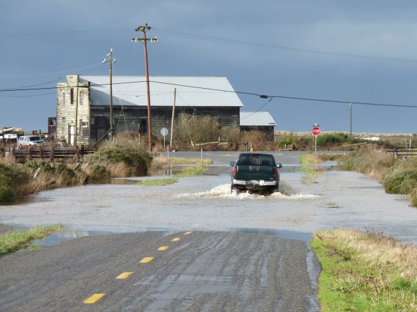
Above: Pine Hill Road south of Eureka flooded by high tide waters of Swain Slough/Elk River, 12-20-10. Photo by Aldaron Laird.
Climate Change, Sea Level Rise, and King Tides
Increases in global sea levels have been recorded by NOAA tide gauges for many years. The steady rise has been attributed to warming of the oceans along with melting glaciers and land-based ice sheets. Climate modeling combined with these direct observations suggest sea level rise will continue well into the future with significant implications for the Humboldt Bay Area’s shoreline. Scientific analyses predict sea level could rise 16 inches by 2050, with upper estimates of more than 55 inches by 2100.
Understanding the future impacts from sea level rise is a first step toward adapting to these changes.


