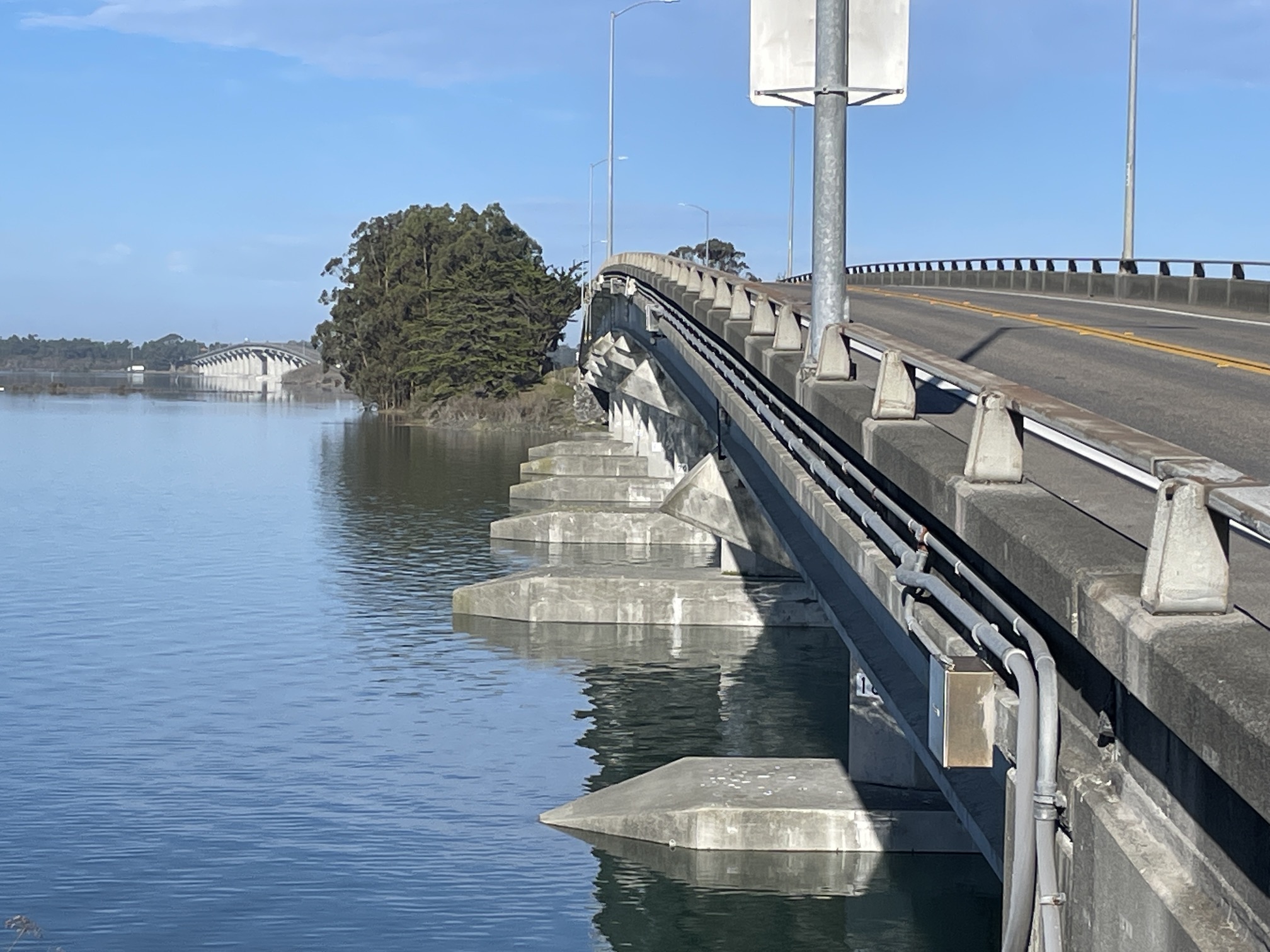
This winter's last set of King Tides will arrive this Friday and Saturday, January 2-3. The current tides are nearly a foot higher than predicted, and with more rain in the forecast and winds from the south, these tides are likely to be even higher than they were in early December. BE EXTREMELY CAUTIOUS when viewing these King Tides! Under these conditions, you may encounter eroding shorelines, rapidly rising water, and flooded roadways. With recent storms, the ground is so saturated that in low-lying areas, there's nowhere for more stormwater runoff to go. As always, wear bright colors so drivers can see you, and never drive through flooded roadways. Photo of the Samoa Bridges on Dec. 4, 2025 by J. Kalt.To get involved, all you need is a camera or a smartphone. The most useful photos are those of water levels along artificial structures like bridges to compare water levels as sea level rises. You can upload your photos to the California King Tide Photo Project, which is a great opportunity to contribute to a long-term dataset, while helping inform residents and decision makers about the need to plan for the coming changes to our natural and built environments. That's because King Tides are generally a foot or so higher than the average high tide, helping us envision what monthly high tides will look like with one foot of sea level rise. Check out these tips on taking and uploading photos.The tides are predicted to peak at the North Spit tide gage at the following times. For times and heights at other locations, check NOAA’s tide predictions or the Coastal Commission's tidemap.
9:53 a.m. on Friday, January 2 (predicted to be 8.69 feet)
10:46 a.m. on Saturday, January 3 (predicted to be 8.68 feet)
 This winter's last set of King Tides will arrive this Friday and Saturday, January 2-3. The current tides are nearly a foot higher than predicted, and with more rain in the forecast and winds from the south, these tides are likely to be even higher than they were in early December. BE EXTREMELY CAUTIOUS when viewing these King Tides! Under these conditions, you may encounter eroding shorelines, rapidly rising water, and flooded roadways. With recent storms, the ground is so saturated that in low-lying areas, there's nowhere for more stormwater runoff to go. As always, wear bright colors so drivers can see you, and never drive through flooded roadways. Photo of the Samoa Bridges on Dec. 4, 2025 by J. Kalt. To get involved, all you need is a camera or a smartphone. The most useful photos are those of water levels along artificial structures like bridges to compare water levels as sea level rises. You can upload your photos to the California King Tide Photo Project, which is a great opportunity to contribute to a long-term dataset, while helping inform residents and decision makers about the need to plan for the coming changes to our natural and built environments. That's because King Tides are generally a foot or so higher than the average high tide, helping us envision what monthly high tides will look like with one foot of sea level rise. Check out these tips on taking and uploading photos.The tides are predicted to peak at the North Spit tide gage at the following times. For times and heights at other locations, check NOAA’s tide predictions or the Coastal Commission's tidemap.


